by Pawinnut Chaiyasuan
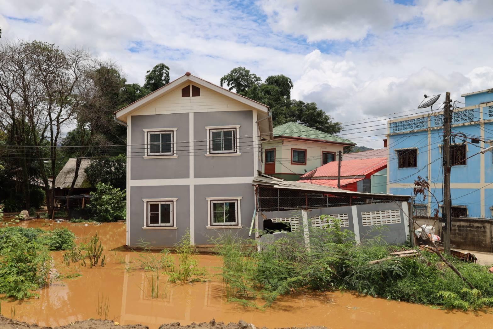
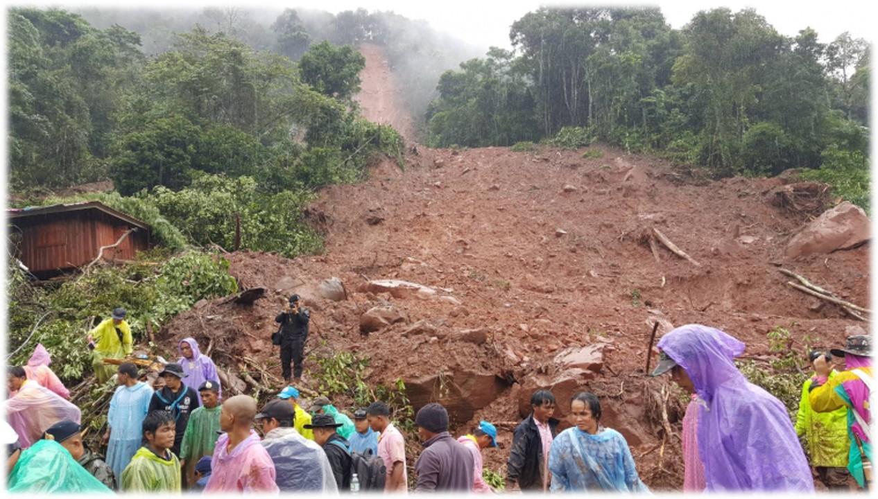
Northern Thailand sits at the intersection of mountains and rivers, a landscape that is as beautiful as it is exposed to natural hazards. The region’s mountainous terrain and dense river networks create conditions conducive to landslides and flooding, risks that have intensified alongside the growth of settlements in high-exposure areas. In September 2024, weeks of relentless rainfall, driven by a succession of storm systems, pushed the region past its limits. Floodwaters surged from the highlands and spilled into towns and farmland below, hitting Mae Sai, Chiang Khong, Thoeng, Phaya Mengrai, and Khun Tan. On the slopes, saturated soil gave way, sending landslides and mudflows through hillside communities in Mae Sai, Wiang Kaen, and Phaya Mengrai. And just as some communities began to piece things back together, the rains returned. Areas like Mae Sai, Mueang, Wiang Pa Pao, and Pa Daet were struck again before they had any real chance to recover, a pattern that disaster researchers describe as cascading disasters. By the time the season ended, 34,131 households across 18 districts had been affected, their homes, livelihoods, and surrounding environment left deeply scarred.
“I’ve lived by Mae Kha Canal for all 74 years of my life. The massive flood that hit us for two months back in ’24. The water reached my neck level. Everything was drowned. We’re the ones bearing the brunt of it. My bedding, my mattress, my pots and pans, all swept away. Everything I owned is just covered in filth now. The flood didn’t just fill my bowl, it emptied my pocket. If I lose 10 Baht worth of belongings, they only give me 3, 4, or 5 Baht back in aid. It just doesn’t add up.”
The voice from Khlong Mae Kha reflects a deep-seated tension of the harsh reality of poverty and disaster. Having lived there for 74 years, the community member represents the soul of the community. Their voice reflects the shock of the shifting climate. Old knowledge of the canal’s behavior no longer applies as the water is unexpectedly higher and disasters are more aggressive than ever before, leaving even the most seasoned residents feeling helpless.
“We faced our worst disaster back in ’94, yet we never truly thought about how to prepare, adapt, or fight back. When 2024 hit, it was a total ecological collapse. The water came from everywhere, the forests, the Ing River, bringing landslides and mudslides with it. We faced everything. But the patterns changed in ’24. It wasn’t just a flood of water anymore, it was a flood of mud. In ’94, we prepared for rising tides, but this year we had to figure out how to survive the sludge. It requires a completely different way of adapting.”
– A member from Ing River Basin community, Chiang Rai
Disasters do not only come from rapid changes in disaster patterns, but development projects, including ones from the state also became one of the causes of the disaster from the North.
“The people of Bang Rakam have always lived with water; for us, flooding was just a part of life. Before the ‘Bang Rakam Model’ was introduced, we lived happily alongside the seasonal tides. But since the policy took effect, our way of life has been upended. Usually, the water would stay for a month or two and then recede. Now, it sits for four or five months. This has a devastating impact on our homes and our lives that the standing water rots the very structures we live in. To make matters worse, there is no state compensation to help us recover.”
– A community member in Bang Rakam District, Phitsanulok
Bang Rakam District is a low-lying basin where 90% of residents are farmers. Traditionally, the area faced seasonal flooding for about a month and a half. This was a natural cycle that supported local fisheries and agricultural farming. In 2017, Bang Rakam Model was introduced. This initiative adjusted the cropping calendar, requiring farmers to harvest by mid-August before the fields were used to store water. Since 2023, the area’s identity has shifted into a permanent “retention zone.” Now, over 400 million cubic meters of water are held for up to three and a half months. This structural change has crippled local livelihoods, leaving residents without income for 6 to 7 months a year. Despite facing extreme flooding and economic loss, the community continues to struggle without adequate government compensation.
Thailand’s disaster management in the past has primarily been conducted through government mechanisms, with the roles and responsibilities of various agencies clearly defined by law and policy. However, in practice, several limitations remain. These include constraints regarding personnel readiness, resources, and timely access to affected areas. Furthermore, coordination among agencies with related missions often lacks unity and is difficult to integrate. This leads to relief efforts that are frequently delayed, insufficient, and fail to truly address the specific needs of the local areas. In addition, operational approaches have focused mainly on emergency response during an event rather than on prevention, preparedness, or proactive risk reduction. These factors contribute to the ongoing vulnerability of the country’s disaster response system and its inability to build resilience within communities. As a complex and dynamic process, disaster recovery plays a crucial role in building community resilience post-disaster (Liu & Mostafavi, 2023). Historically, discussions around reconstruction were centered around the micro-, and on macro- economic reconstruction but it is now recognized that that community-driven or bottom-up approaches, for example the empowerment of communities in a co-strategic, partnered relation can make for more equitable and sustainable outcomes (Joseph et al., 2021). Moreover, the community-driven model recognizes that involving the affected communities as co-partners in planning and implementing recovery not only provides space for ownership but also utilizes local resources and knowledge which are often neglected in the top-down approaches (Ngulube et al., 2024).
From “Passive Recipients” to “Active Local Disaster Managers”: Community-Driven Response and Management
Pre-Disaster: Database Management and Traditional Knowledge
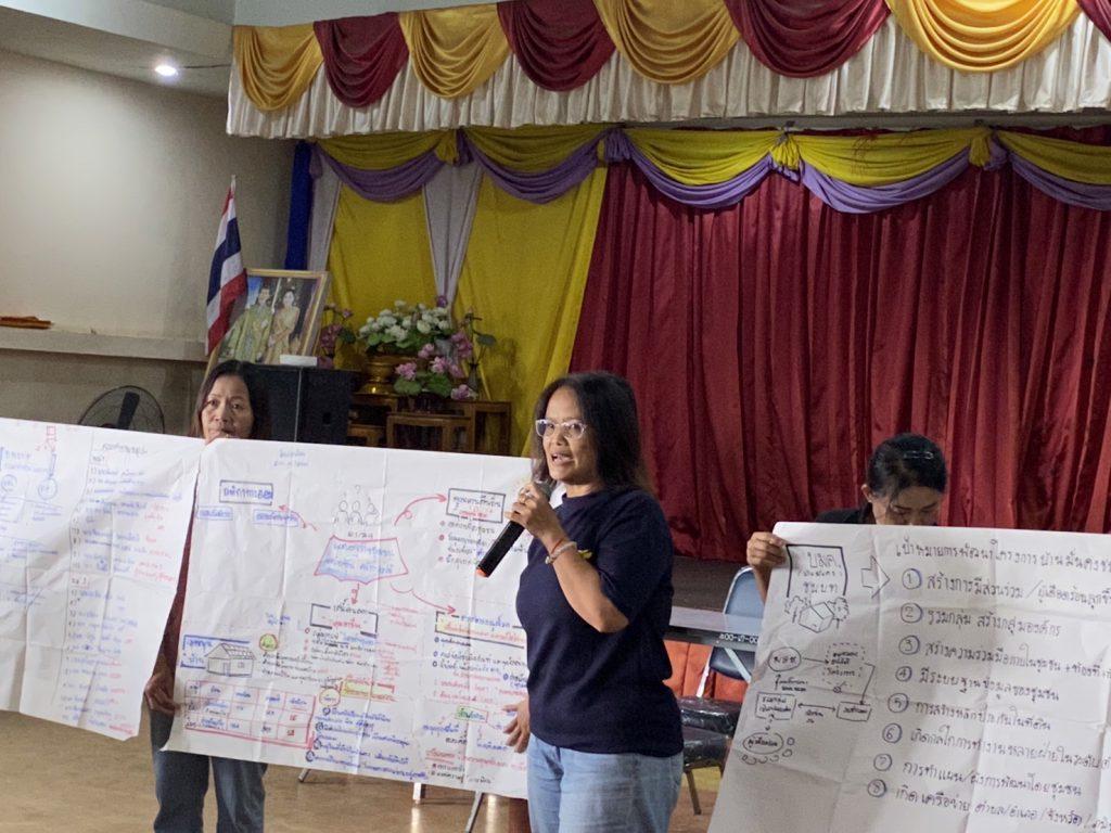
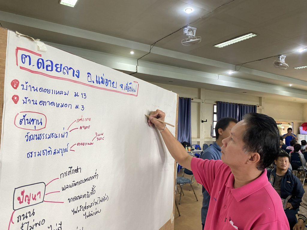
Disaster preparedness among Northern communities emphasizes the concept of “knowing the area and knowing the people.” This approach shifts the community’s role from passive recipients of aid to active local disaster managers. By drawing on historical experiences, communities proactively plan across several key dimensions:
Community Mapping and Vulnerable Group Datasets
Residents collaboratively develop community maps to identify high-risk zones and historical flood levels. Concurrently, household-level surveys are conducted to map vulnerable groups, including the elderly, children, and bedridden patients. Georeferencing these households ensures that assistance is prioritized and deployed immediately when a crisis occurs.
“First of all, there must be a community map. We need to know the water levels in our area… People in the community must fill three roles: 1. Leaders, 2. Doers, and 3. Followers… These leaders must then step up to find external organizations for support.“
– A community member from the Northern Community Network
Resource Mobilization and Assistive Equipment
In Ing River Basin of Chiang Rai, preparedness extends to individual-level assistive needs. The community stockpiles specialized beds for bedridden patients and the elderly at evacuation centers in advance. They calculate exactly how many beds must be dispatched to specific zones based on rising water thresholds. Furthermore, local temples and schools are utilized as social capital to cultivate community gardens, ensuring a steady supply of ingredients for “communal kitchens” during emergencies.
“We prepare assistive equipment and beds for patients, the elderly, and the bedridden. We have a clear plan, for instance, if a certain zone floods, we know how high the elderly need to be placed and how many beds must be sent. We even have a dedicated bed distribution center.”
– A community member in Chiang Rai
This integration of social infrastructure into disaster logistics demonstrates how communities convert existing social capital into tangible preparedness resources.
Spatial Management and Traditional Ecological Knowledge
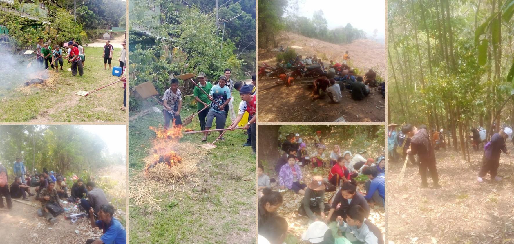
In the highland areas of Mae Hong Son, where landslide risk is acute, preparedness focuses on watershed ecosystem management. Communities apply traditional ecological knowledge to establish land-use zoning, marking community forests, conservation areas, and agricultural land, thereby reducing environmental degradation that heightens disaster risk. Annual inter-village consultations are held to allocate fire prevention responsibilities and construct wildfire containment lines collaboratively.
“Villages and communities establish regulations and spatial management through zoning, which is rooted in traditional knowledge… We coordinate with surrounding villages through annual meetings to allocate fire prevention responsibilities among neighbors.”
– Community representative from Mae Hin Luang Village, Mae Hong Son
Early Warning Systems and Communication Network Establishment
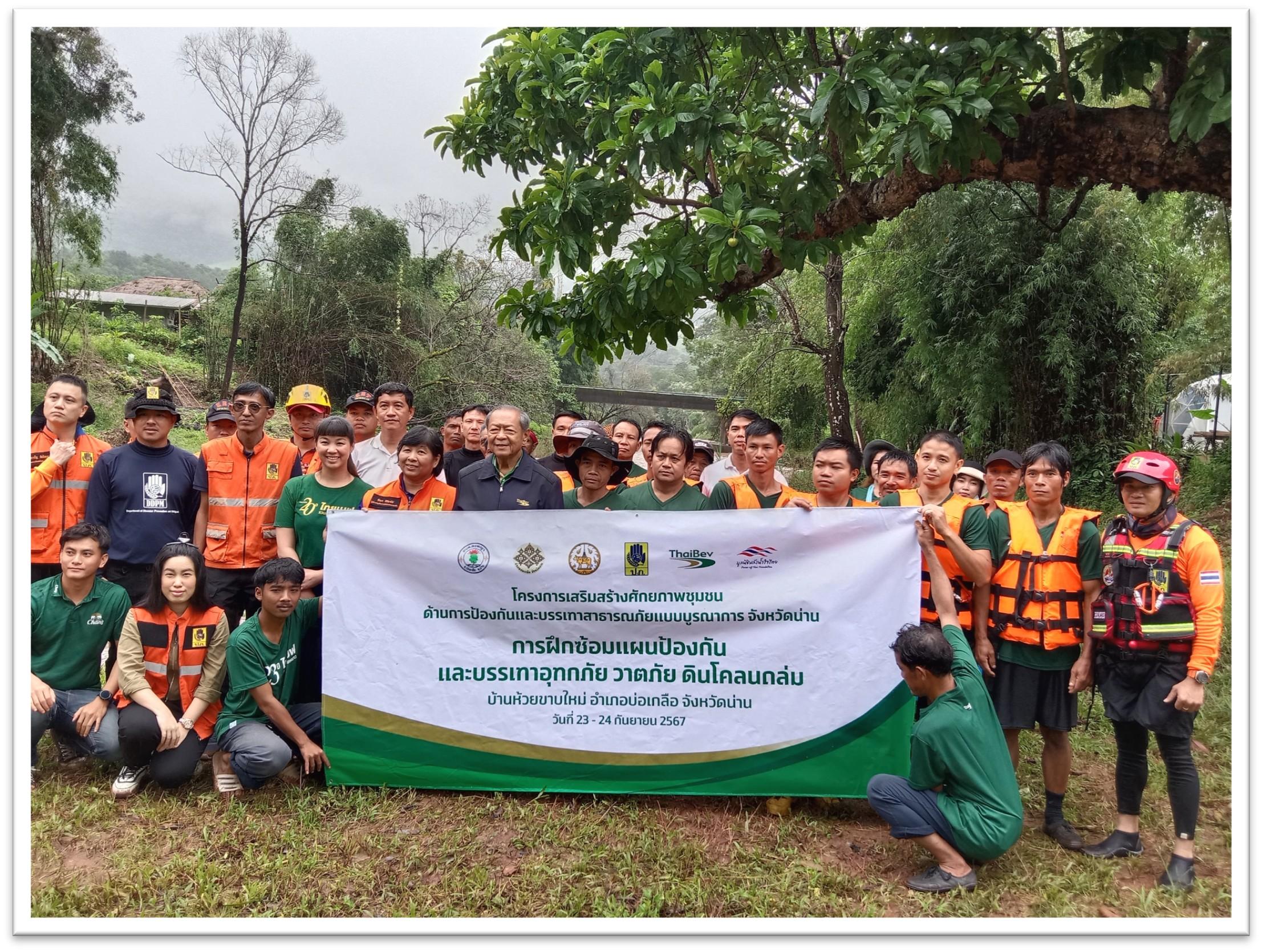
Beyond data and planning, communities have established people-centered early warning systems using widely accessible platforms, such as Line, Facebook, and two-way radio to relay real-time information on water levels and landslide risks from upstream to downstream communities. These low-cost communication networks function as informal but effective last-mile alert systems.
These pre-disaster practices reflect the operationalization of community resilience theory in practice. By converting local knowledge, spatial data, and social capital into actionable preparedness frameworks, Northern Thai communities show a capacity for self-organized disaster management that does not depend on the prior arrival of central authorities. Their experience offers a replicable model for integrating bottom-up resilience into formal disaster risk reduction strategies.
During Disaster: Coordinated Response and Community-Driven Operations
When disaster strikes, Northern Thai communities activate pre-established systems with speed and precision, moving from preparation to action. Rather than waiting for external directives, community networks self-mobilize, drawing on their pre-disaster data, local resources, and inter-community relationships to manage the immediate crisis.
Early Warning and Real-Time Communication
The transition from alert to action begins with community-operated early warning systems that link upstream and downstream areas in real time. When flooding or landslides occur in highland zones, residents immediately send information through social media platforms and two-way communication channels to communities in lower-lying areas, enabling timely protective action before official alerts arrive.
“There is a warning system covering both upstream and downstream areas, including the highlands. If a flash flood occurs on the mountain, they will immediately notify those below: ‘the water is coming, prepare yourselves.’ We use mobile phones, Line, and Facebook to warn each other: ‘the water mass has now reached this level…”
– Community representative, Chiang Rai
Rescue, Evacuation, and the Role of Pre-Disaster Data
Pre-disaster household databases become operational tools the moment a disaster unfolds. Communities use these records to locate and evacuate elderly residents, young children, and bedridden individuals to pre-designated safe zones, without delay and without the need to reassess who requires assistance. Temporary evacuation centers, identified in advance as community coordination hubs, serve simultaneously as shelters and as points for receiving and distributing incoming relief.
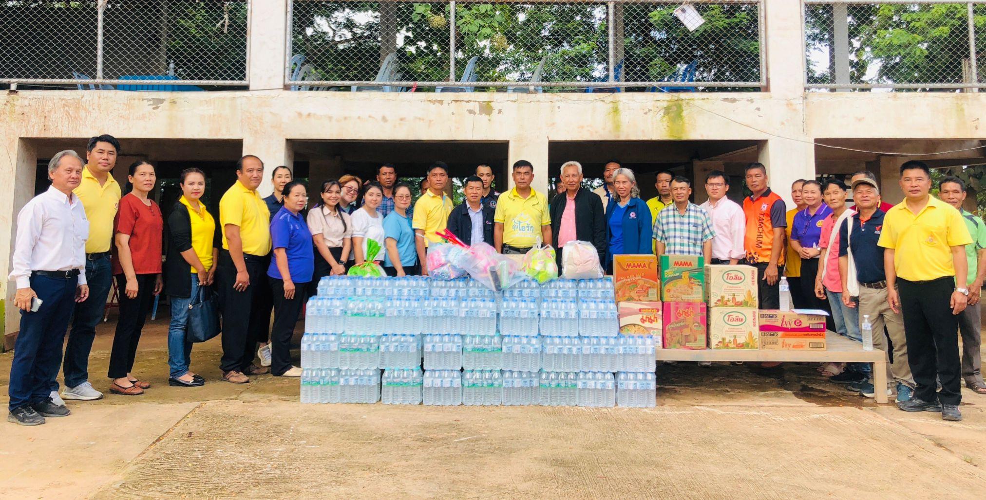
Communities do not work in isolation during this phase. An inter-community solidarity mechanism, especially for supporting those in crisis, activates spontaneously across the network. Community organizations from unaffected areas mobilize rice, dry food, and volunteer labor, deploying these resources to crisis zones immediately and without waiting for central authorization. This decentralized mutual aid model significantly reduces the response gap between the onset of disaster and the arrival of formal assistance.
Communal Kitchens and Local Resource Mobilization
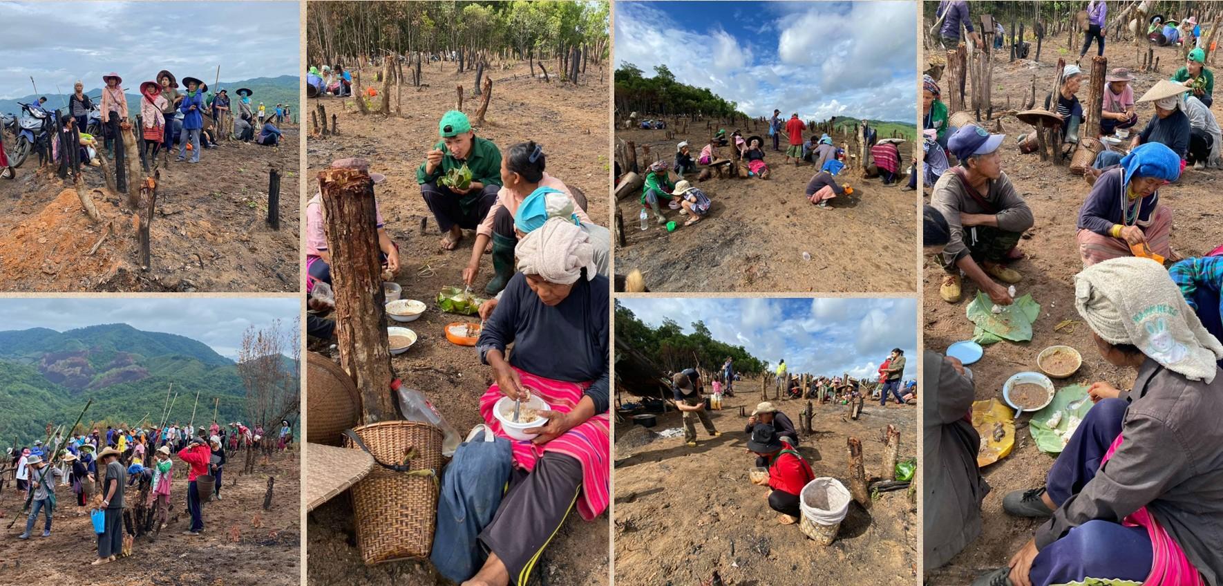
In the immediate aftermath, when external aid has yet to arrive, communities assume responsibility for food security. Communal kitchens are established to prepare and distribute meals to displaced residents and to vulnerable individuals unable to leave their homes. Local assets are mobilized inventively. In Chiang Rai, vegetables cultivated by novice monks in temple gardens become a primary food source for communal kitchens serving entire watershed communities. Simultaneously, community networks from neighboring provinces channel dry goods and staples into affected areas.
Integrated Coordination with Network Partners and External Actors
Community-driven response is not pursued in isolation from formal systems. Community councils and welfare funds coordinate with government agencies, including the Department of Disaster Prevention and Mitigation, local administrative organizations, the military, and NGOs, through joint operations centers. This integrated model ensures that external resources are channeled efficiently and reach the most affected populations. Pre-planned distribution systems for assistive equipment, beds, and medical supplies for bedridden patients and elderly evacuees are executed concurrently, in accordance with pre-disaster allocation plans.
The during-disaster phase shows a response model that is simultaneously fast, targeted, and adaptive. Pre-disaster investment in data, relationships, and local resources pays clear dividends in the form of reduced response time and more equitable reach. Vulnerable populations, who are most at risk of being overlooked in top-down relief systems, are precisely the groups these communities prioritize first. This evidence points to the value of institutionalizing community-driven response mechanisms within national disaster risk reduction frameworks, rather than treating them as informal supplements to state capacity.
Post-Disaster Recovery and Forward Planning: Rebuilding with Local Power
Housing and Livelihood Restoration
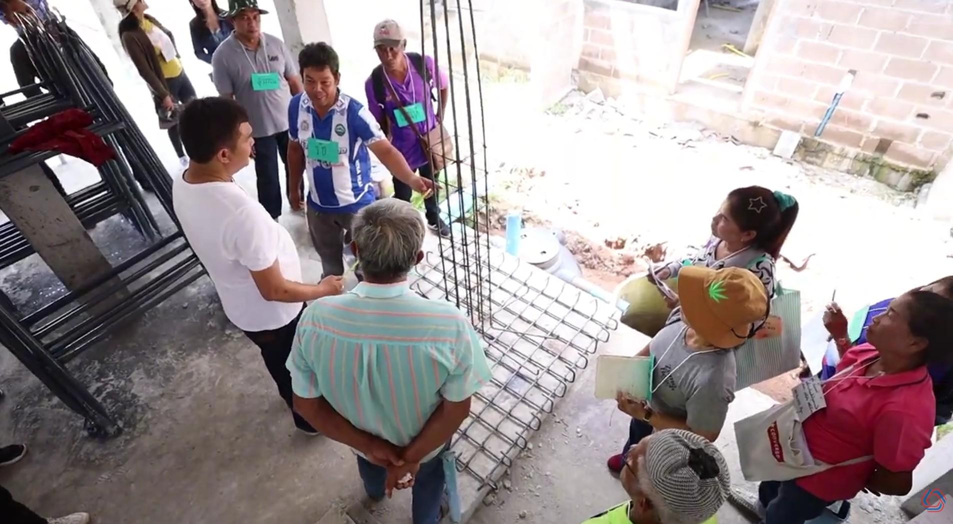
Post-disaster recovery in Northern Thailand does not depend solely on state budgets. Instead, communities activate a network of volunteer technicians, builder, and repairers known as “Community Builders Team.” These builders are often disaster survivors themselves who volunteer to repair their neighbors’ homes. Through initiatives like the Rural Baan Mankong Project, the goal is to bring stability back to families in severely hit areas. In Chiang Rai alone, more than 12,297 households suffered damage so severe that their homes became uninhabitable. The success of this community-driven construction relies heavily on local trust and mutual support.
“We started as disaster victims ourselves, and then we developed our skills to become builders. Hiring outside contractors is very expensive. But with community builders, we see each other’s faces every day, whether it is our own house or a neighbor’s. The community is sincere. We work for real and we never abandon our people.”
– Koramit Panya, Community Builder Team
At the same time, restoring the local economy is a major priority. To help network members stand on their own feet, partner organizations provide financial relief, including low-interest livelihood loans and a one-year suspension on both principal and interest payments. Communities also find creative ways to generate income. For example, in Mae Hong Son, residents revived their economy after the disaster by promoting community-grown coffee.
However, gaps in state support remain a challenge. Residents along the Mae Kha Canal in Chiang Mai have noted consistently that official compensation assessments fall short of actual losses sustained, pointing to a structural tension between standardized state relief mechanisms and the lived complexity of disaster impact on the ground.
The Challenges of Relocation and Legal Barriers
When disasters become a repeating threat, communities are sometimes forced to move entirely. Huay Kham Village in Mae Hong Son with more than 60 households had to relocate to escape constant environmental dangers. This process highlights major systemic difficulties. Finding safe, legal land often means requesting permission to use national forest reserves, a bureaucratic process that takes months. On top of that, displaced residents frequently face complicated legal hurdles regarding civil and house registrations, making long-term recovery a slow and exhausting process.
“We moved the entire village of over 60 households. After moving, we had to live in temporary shelters. It took a year and a half just to get the land permissions and build the houses before our lives could return to normal.”
– Village Chief of Huay Khab Community
Community-Driven Urban Planning and Action Plans
Rather than waiting for top-down policies, northern communities are actively designing their own space-based and policy proposals to prevent future disasters. They focus on four main areas:
1. Area-Based Ecosystem Planning: In Ing River Basin Community of Chiang Rai, residents came together to build an area-based planning for the entire river basin instead of planning village by village. They realized that environmental risks are connected across the whole ecosystem. They also updated their old strategies. They learned that plans made for standard floods (such as the major flood in 1994) do not work against modern mudslides. Their new model is structured into four clear phases: immediate response, urgent relief, medium-term recovery, and long-term adaptation.
2. Community Mapping & Data: In Chiang Mai and Chiang Rai, communities are working to turn emotional panic into objective data. By mapping exact household coordinates and past water levels, they can make precise evacuation plans. This data tells them exactly how many medical supplies or specialized patient beds need to be sent to specific zones when water reaches a certain height.
3. Local Zoning and Modern Urban Planning: In Mae Hong Son, communities use traditional knowledge to set strict zoning rules, dividing community forests, conservation zones, and farming lands to prevent future landslides. Meanwhile, residents in Chiang Rai are pushing for a city plan designed by locals rather than central planners.
4. Policy and Partnerships: In Bang Rakam, Phitsanulok, residents formed a 9-point proposal for government agencies. This proposal demands a joint water management system and creates a monitoring committee where local citizens hold active seats. Similarly, Chiang Rai locals have proposed combining scattered disaster laws into a single, unified legal framework with one clear lead agency.
“Chiang Rai is a city of 7 rivers and 35 wetlands. The problem is that the current urban planning relies on outdated models from the past. The city plan must be determined by the people of Chiang Rai themselves, and it must be flexible enough to adjust when things change.”
– A member from a Chiang Rai Community Network
Lessons in Resilience: Community Strengths and Insights for Development Practice
The Core Pillars of Community-Driven Strength
What makes these Northern Thai communities capable of managing major disasters on their own? Their strength relies on four internal factors:
From Victims to Active Managers
The primary driver of strength is the shift in local mindsets. Community members do not view themselves as passive victims waiting for charity, but as active managers of their own safety. This self-reliance functions because the community organizes itself into three clear roles: leaders, doers, and followers. Because this social structure is already active before a crisis hits, it creates a powerful peer-to-peer network. Empowered communities do not just rescue themselves; they accumulate enough collective strength to share resources and extend help to neighboring areas during a crisis. When one village is hit, unaffected neighboring villages and other network agencies can immediately deploy resources without waiting for official government orders.
Social Capital and Horizontal Network Solidarity
The community relies on existing, trusted local assets to drive recovery. They use familiar spaces, such as temples and village schools as secure storage areas and communal kitchens. This trust is also evident in their housing recovery. By using volunteer community builders who are disaster survivors themselves, they reduce construction costs and ensure high commitment. Because neighbors see each other every day, there is a sincere cultural promise that no one will be left behind.
Community strength does not exist in isolation. It is on network building as well. Northern communities have built strong horizontal networks that link different villages together, connecting upstream mountain areas with downstream valleys. This cross-village network allows for rapid, real-time communication during a crisis. When a disaster strikes, this pre-existing network activates a system of mutual aid, allowing unaffected villages to automatically send food, volunteers, and emergency supplies to hard-hit areas.
Turning Drama into Data
Sustainable development relies on facts rather than emotional narratives. Northern communities have successfully learned to transform stories of hardship into structured digital data, risk maps, and precise lists of vulnerable households. This grassroots data allows them to execute precise evacuation plans, knowing exactly when and where to send specific medical equipment before flooding worsens. Furthermore, by using everyday communication tools like Line and Facebook, these networks send real-time water level updates from mountain peaks to low-lying valleys. The grassroots warning system protects lives long before official government systems can respond.
Traditional Knowledge and Ecosystem Awareness
In highland areas like Mae Hong Son, community strength comes from traditional ecological wisdom. Locals use traditional zoning practices to divide community forests, conservation zones, and agricultural lands, which naturally prevents severe landslides. Furthermore, they do not look at environmental risks through isolated village borders. They look at the entire river basin as an interconnected ecosystem, allowing them to coordinate wildfire and flood protections with surrounding villages.
What Development Practitioners Can Derive from This Experience
Community Participation Must Mean Community Leadership
The localization agenda in humanitarian and development practice has long advocated for greater local ownership. What the Northern Thailand case demonstrates is that participation, in its conventional consultative form, is insufficient. The communities examined here were not consulted, they led. They designed their own data systems, determined their own evacuation priorities, managed their own resources, and advocated for their own policy reforms. Development practitioners should therefore move beyond designing programmes that include communities toward supporting conditions under which communities can design and manage programmes themselves. Furthermore, practitioners should stop focusing purely on delivering post-disaster supplies and start investing in local capacity building. The most sustainable role for external agencies is to support existing community structures. Helping communities digitize their local knowledge, refine their household datasets, and strengthen their internal networks creates a permanent safety net that outlasts any single aid project.
Invest in Data Owned by Communities
The movement from drama to data, as communities themselves describe it, is one of the most significant development achievements documented in this study. Yet community-generated data remains systematically undervalued in formal disaster risk reduction frameworks, which tend to privilege technically produced assessments over locally held knowledge. Practitioners should advocate for and support investment in community information systems that communities themselves control, that are interoperable with government databases, and that are updated continuously. Effective disaster management does not require expensive, highly complex early-warning systems. Communities also use everyday communication tools like Line and Facebook to share information. Integrating these highly accessible, familiar digital tools into formal development projects ensures higher community adoption and faster communication during emergencies.
References
Joseph, J., Irshad, S. M., & Alex, A. M. (2021). Disaster recovery and structural inequalities: A case study of community assertion for justice. International Journal of Disaster Risk Reduction, 66, 102555. https://doi.org/10.1016/j.ijdrr.2021.102555
Liu, CF., Mostafavi, A. Network diffusion model reveals recovery multipliers and heterogeneous spatial effects in post-disaster community recovery. Sci Rep 13, 19032 (2023). https://doi.org/10.1038/s41598-023-46096-x
Ngulube, N. K., Tatano, H., & Samaddar, S. (2024). Factors impacting participatory Post-Disaster relocation and housing reconstruction: the case of Tsholotsho District, Zimbabwe. International Journal of Disaster Risk Science, 15(1), 58–72. https://doi.org/10.1007/s13753-024-00536-y